Remember the first time you tried Google maps and were in awe at how you could zoom right in on those cool aerial views to see the buildings and streets you know and love? Prepare for that feeling all over again with Seety which is a street mapping service put together with photos taken by a car that was driven all over London.
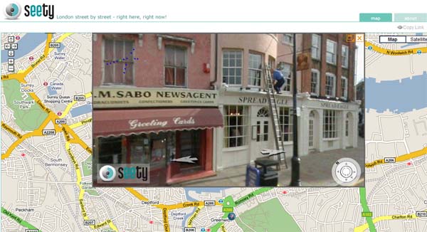
I took a look at Greenwich on Seety, and it really is impressive. You can even see people walking, drivers in cars, and in this example below, someone up a ladder at the Spread Eagle.
If you haven’t seen it yet, have a look and see what you think – interesting bit of fun, ideal for curtain twitchers or a possible invasion of privacy? Also, it strikes me that sending someone around in a van is a bit inefficient and the whole thing could have been done with user contributed content that was GPS tagged.